I am not qualified to be talking about this but hey.
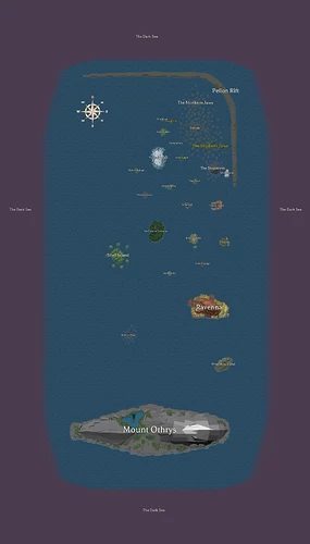
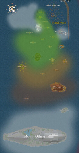
So after looking at this map and puzzling over how the hell we have blasted rock and Frostmill in the same sea, a fraction of a world apart, I came up with a conclusion on the climate of the Bronze Sea.
In the Nimbus Sea, which is assumably southeast from Ravenna, we know there is a kingdom called Sameria within a large or a few large deserts.
My theory is that dry, hot winds blow northwards from Sameria, hitting the warm Ravenna and Blasted Rock first. Wind-row is also affected by the wind but less of the heat and more of the barren dryness.
The wind currents continue northwards, past islands which can be assumed to be warm such as Munera, Shell and Sandfall, and islands such as the Forest which is described to be a swamp and also possibly of a more moderate temperature.
However the winds quickly cool down as islands get both more sheltered by mountains such as the Stepstones and the Jaws, and due to the distance from Sameria at that point.
This leads to more northern islands being of colder temperatures.
Islands such as Whitesummit and Redwake are also almost completely sheltered from warm winds. If we ignore Mango and Goso. Which I’m just labelling as anomalies for the moment.
Pelion Rift also plays a huge part in sheltering the northern islands, creating a barrier from winds coming in from the dark sea.
I’ve imagined Keraxe to be colder due to its Nordic inspiration. Any cold winds or storms blowing north from Jotunheim and The Asgard down south would hit the colossal Orthys and not reach the Bronze Sea.
Just realised Jotunheim is probably a sea name now.
Anyway so this is my little thing, but remember.
It’s just a theory. A game theory.
Roll credits
Either that or Vetex just made it all up as he went along.

