Misleading Treasure Charts: A Theory

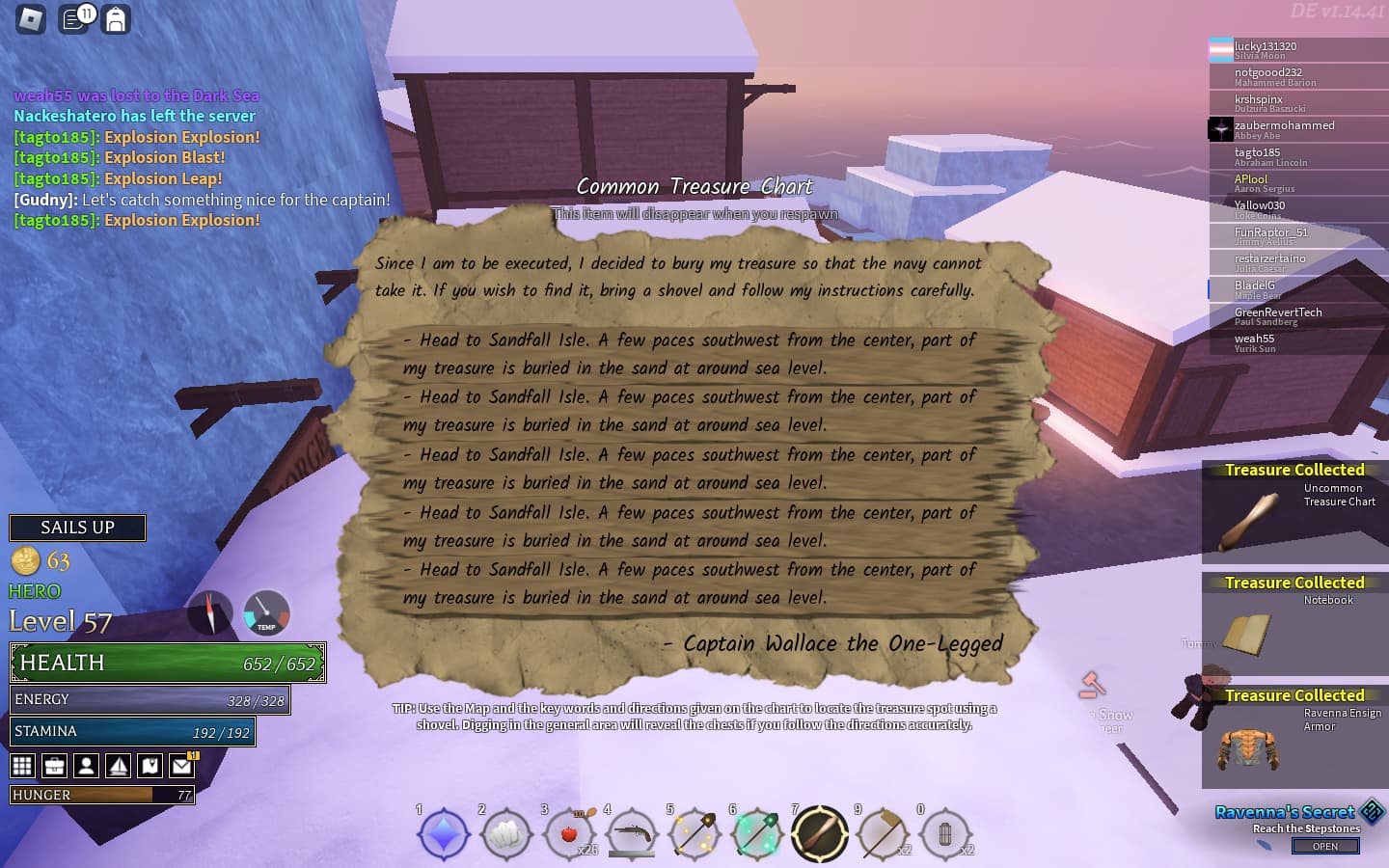
As I’m sure many people know, treasure chart directions aren’t the most reliable. With the addition of goldsight, and the treasure chart website, they’ve become more manageable, but has anyone stopped to wonder, why exactly treasure charts can be so weird and misleading?

Well, I believe I have found a possible explanation for this. Firstly, let’s consider the four parts of chart directions: Material, Height, Direction, and Distance.

The material of the part is always correct, as is obvious, and the height is generally accurate. While “sea level” and “decent height” are a little misleading sometimes, I believe it’s based on the part’s y-level, and determined based on preset values of height. So if the part is above one height and below another, it gets categorized as a certain height.

Direction is roughly accurate, though it’s a little hard to tell due to some islands having weirdly tilted shapes. That’s where the chart website comes in, as it does help indicate where exactly “south southeast” is, for example. However, direction and especially distance are the two variables that mess up the most commonly, and this is what I’m considering.

Distance is how far the part is from the island’s center. “few steps”, “halfway”, or “edge”.
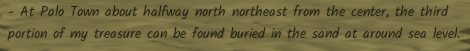
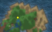
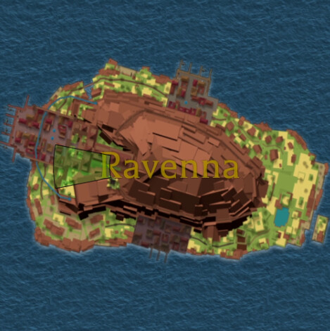
Now, it’s mostly likely determined by a radial check from the island’s center coordinate, but very commonly, the text is deceiving. At Ravenna, halfway is near the edge. At Cernunno, a similar case exists. At Palo, I once found a few paces chart that was on the shore. I recall seeing a Thorin chart with a similar problem. But why? Why does this happen?

Well, I am going to bring up two things that are crucial in deciphering this:
Hidden sections of parts, and the way a roblox part’s location is determined.

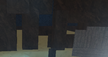
You see, parts do frequently extend below other parts and walls. While only a small section may show, they sometimes extend deeper than you may imagine. Secondly, roblox parts are determined at the center, in height, depth, and width. Now, how many assume charts work is that a random part on the map that is eligible for charts is selected. However, the thing is, it is likely that the chart’s directions are determined based on the selected part’s roblox position.

That means, on a part that is particularly long or large, the center is a far offshoot from where you’re digging. If this is how charts are generated, that means that the relative position is from the part’s center to the island, not the part as a whole. That is why sometimes the direction can be so inaccurate; large parts that extend far underground have a center that is far from where you’re digging. The game determines it as “halfway”, for example, but the only revealed section is near the edge.

Now again, this is just theoretical. But if my assumptions are correct, than that is why the chart’s distance can be so inaccurate at times. This also applies to wide parts, which is why the direction is occasionally wrong too.

1 Like


also this is one of the base treasure charts
similar to how sometimes your brig used to spawn with the cubes instead of all the stations and with the sameria banner.

It changes to the actual chart once you re-equip it, since it didn’t get time to pick the location yet (I think)

1 Like

This is why mango isle is the best treasure island, literally only has 4 possible parts to dig in

4 Likes

i aint reading allat so
the ground type is the cheat code that most people forget
the elevation is rarely useful. in fact its almost only good when you forget to check the ground type, with a “sea level” reminding you its in sand at shell island or whatever
the distance is the center of the island to the edge of the island name’s radius so for any non circular island halfway is almost the entire island

image

I dunno what its all about, once you understand how charts work, they are easy to solve even with chart-solver.

I’m basically just trying to figure out why charts are sometimes misleading.

I don’t have much trouble with charts usually, this is just a guess about the way vetex coded it.

charts are usually p easy, especially with the HD map quality now making it easier to parse different terrains and elevations, the only problem I’ve seen is that in Ravenna SE, there’s some terrain that’s hidden under other terrain that needs to be destroyed, and some people have gotten some treasure charts that lead to those spots

palo town is an absolute offender of misleading treasure charts
Screenshot 2023-10-14 102100
(the location of the treasure)
Screenshot 2023-10-14 102211
i had to go under palo just to get this chest

Wait, what?
Ravenna has parts hidden under other ones?

Is that in the secret area

It’s in a secret area, but not the secret area.

besides, the secret doesn’t have spots i could dig in, as far as i’m concerned

huh, I can’t say I recall any sand parts there besides maybe the cannon fist mentor
but that’s not cannon fist guy’s spot, right?

Screenshot 2023-10-14 102200

There’s a bunch of rocks at the cannon fist mentor’s area that hide the room. The treasure spot was at the far edge of the hidden room. As far as I’m concerned, you weren’t even supposed to go in here w/ the absence of treasure.

my goodness
I did not even know that existed

2 Likes

what the hell
why does that exist

Why Vetex WHY???

craziest one i had recently was something among the lines of. Halfway west from the centre of ravenna
image
theres not alot of diggable parts but ok, there are places to still dig.
after using marking shovel, i cover everything in that green area, even the grass ontop of the houses. but sometimes the finder isnt super accurate and i always do more than what is shown. and i still dont find it. Istg i looked everywhere, even the grass parts below and under that green zone.

1 Like

Guess what I found today


1 Like

at Shell Island, edge means the outer islands

ravenna sea level could either mean the literal sand, or the ledge above said ‘sand’ where 90% of the players walk
also for some reason treasure can be buried IN THE CASTLE’S GARDEN

i dont get it